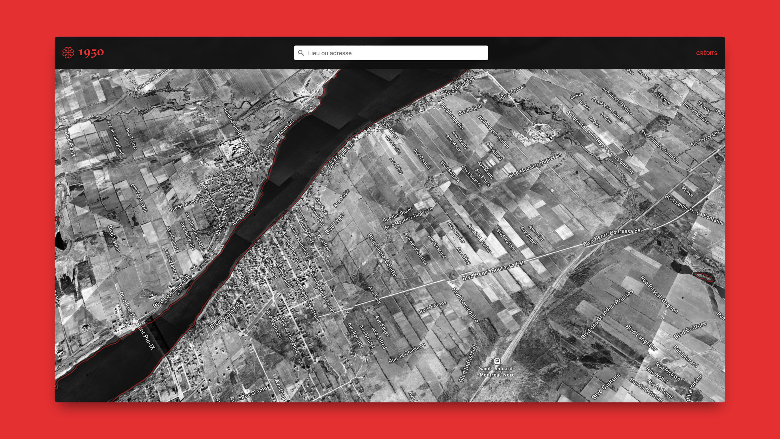
The Project
The city of Montreal has shared on its open data portal the archival aerial photographs belonging to the geomatics division. More than 22,000 photographs are listed there, covering the period from 1930 to 2003. After verification, the first aerial flight project that covers the entire territory of the island of Montreal appears to have been carried out between 1947 and 1949. However, although a summary geographic index is available, these images have never been georeferenced and made available to the public in a single map.
I automated the georeferencing of the few thousand images from the 1950 project, and integrated them
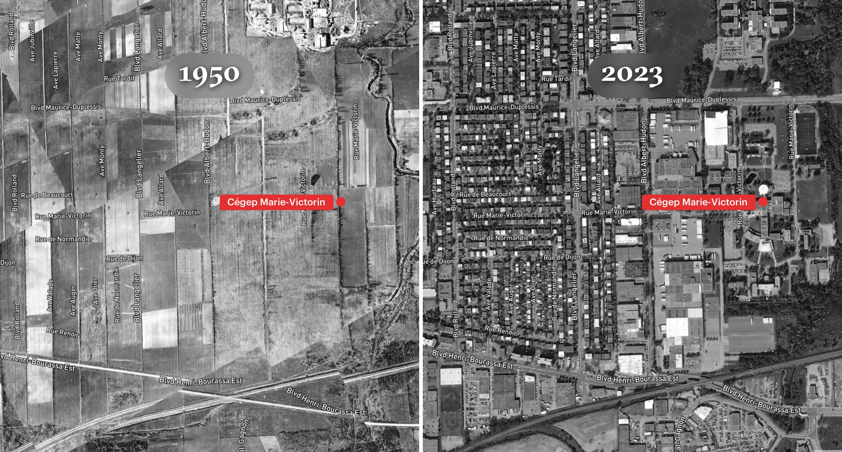
into a web application for exploration. The application allows you to search for a location, and
then use a slider to compare the 1950 territory to the 2023 imagery.
Contact me by email if
you would like to access the georeferenced images for a project.
Sources
Archives de la Division de la géomatique
Photothèque: 1930-2003